|
|
|
Cirencester.co.uk
- Cirencester Shop
|
|
To purchase
any of the Cirencester products below, simply click on the item
you wish to purchase.
 |
Explorer
Map 0169: Cirencester & Swindon, Fairford & Cricklade
(Explorer Maps)
Ordnance Survey
This
map is part of the Ordnance Survey's Explorer series designed
to replace the old Pathfinder map series. At 1:25,000 scale
this detailed map shows a host of attractions including
gardens which are open to the public, nature reserves and
country parks as well as all official footpaths, bridleways,
roads and lanes. Other facilities covered include: camping
and caravan sites, picnic areas and viewpoints, selected
places of interest, rights of way information for England
and Wales, National Trail and Recreational Path routes,
and selected tourist information. The main advantages of
this map are the geographical design of the sheetlines to
capture the best local coverage, and the coverage of a larger
area for value for money. The series is aimed mainly at
the experienced map user but can be used by tourists and
locals alike.
|
| |
|
|
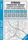
Stroud,
Cirencester, Pursley, Tetbury, Nailsworth, Minchinhampton,
Wotton-under-edge, Chalford (Streetmaster Street Maps)
Map
covering the local area.
|
| |
|
 |
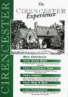
The
Cirencester Experience: Roman Corinium - "The Capital
of the Cotswolds"
The
Cirencester Experience illustrated circular walk and town
guide. Roman Corinium "The Capital of the Cotswolds"
This town guide not only shows you around this Roman Town
but also entertains with the hidden history behind what
a modern visitor can see.
Illustrated by Cotswold Artist Peter Reardon, Town Quiz,
Map of the Town Centre and 3 spur maps. A must for anyone
wishing to explore this Roman town.
A
publication by REARDON PUBLISHING the Cotswold Publisher
a family run publishing house based in the Cotswolds using
local authors and having the books printed in the Gloucestershire
Cotswolds, Reardon Publishing are also able to offer a whole
range of Cotswold books along with maps and videos mostly
in the specialised subjects of Walking, Cycling, Driving,
and tourism in both the Cotswolds and associated Counties.
|
| |
|
|
The
Cirencester Experience Pack
The
Cirencester Experience illustrated circular walk and town
guide book and tape. Roman Corinium"The Capital of
the Cotswolds" This town guide not only shows you around
this Roman Town but also entertains with the hidden history
behind what a modern visitor can see.
Illustrated by Miriam Harrison, Town Quiz, Map of the Town
Centre. A must for anyone wishing to explore this Roman
town.
Box
Contents
Town
Guide Book An illustrated guide to what you can see in and
around Cirencester. Town Walkabout Tape Your personal guide
leads you through the history of this great town.
Town
Map and Quiz Questions/Answers on town with notepad and
pen.
|
| |
|

|
Maxwell
Davies - A Tribute
One
of the pieces of music on this CD was performed by the Cirencester
Grammer School Chior
|
| |
|
|
The
design, concept and content of the Cirencester web site is the
intellectual property of Commatic
Limited. No part of this web site, including images, graphics
and text, may be re-produced or stored, in any manner, without
permission.
E-mail
: [email protected]
|
|